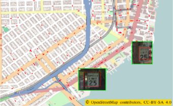
Maps Services, like those in Google and Bing, usually provide us with a picture of what the schema of streets and buildings looks like from above. They also give us the ability to check for additional information, like traffic data and points of interest (POI). The problem is that this list of POI is typically limited and does not include specific things like speed limits, bus stops, or parking signs.
We decided to create an AI engine that would be able to collect POI right from the street cameras and place them on the map using machine learning. In this article, we will stick with the speed limit signs.


